Smart Water Monitoring Network Goes Live at Major Yellow River Irrigation Zone in Eastern Henan
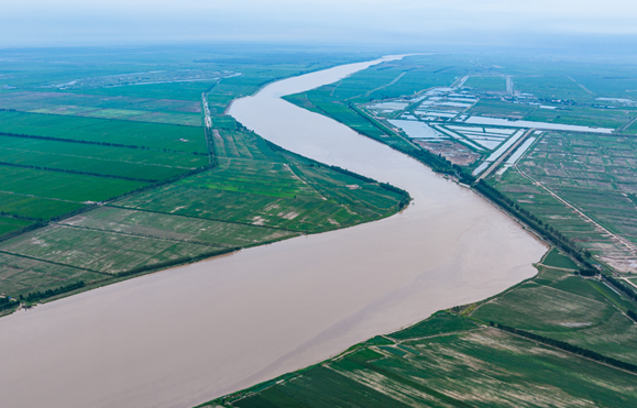
On the southern bank of the Yellow River across the Eastern Henan Plain, a fully integrated digital water monitoring framework transforms centuries-old irrigation management practices, built around 213 automated flow monitoring stations, three sediment observation posts and a dedicated wireless sensor communications backbone.
The full installation, testing and commissioning of the digital infrastructure supporting Phase Two of the Zhaokou Yellow River Diversion Irrigation District has now concluded, with the system operating at steady capacity. The engineering work was delivered by China Communications Construction Fourth Bureau under China Telecom, deploying advanced communications technology to overhaul water resource administration for a large-scale agricultural irrigation network.
Phase Two of the Zhaokou Yellow River Irrigation District ranks among China’s 172 national major water conservation projects. Its designed irrigation coverage spans 2.205 million mu of farmland, stretching across five counties – Zhongmu, Tongxu, Qi County, Taikang and Zhecheng – alongside three urban districts under Kaifeng’s municipal jurisdiction. The scheme delivers core public infrastructure that safeguards regional grain output and underpins sustainable agricultural development across vast farmland stretches.
Custom-built to meet demand for precise, fully digitalised irrigation zone oversight, the integrated system leverages telecommunications infrastructure, intelligent sensor hardware and big data analytics to create a three-dimensional monitoring ecosystem covering main open canals, field branch ditches and sediment ecological tracking. Eighty-three automated flow stations have been erected along primary water channels, with a further 130 monitoring units installed across field-level distribution ditches, alongside three specialist sediment measurement facilities and supporting end-to-end cyber security systems.
Every station is fitted with high-precision sensors that transmit real-time metrics including water levels, flow volumes, discharge velocity and sediment concentration via private wireless networks to a central management platform. The architecture enables sub-second data capture, encrypted transmission, automated data validation and continuous dynamic aggregation, granting operators complete visibility, accurate volumetric measurement and responsive remote regulation of every water allocation unit within the zone.
All monitoring hardware has completed full on-site calibration and runs uninterrupted as a unified sensing network. Once the entire digital framework enters full operational service, the irrigation district will deliver sharper accuracy in cross-basin water allocation, streamlined irrigation delivery for farming households, granular routine maintenance for waterworks assets and evidence-led ecological oversight of river water quality. The digital upgrade will unlock layered long-term gains including reduced water consumption per unit of crop yield, elevated grain production volumes, enhanced watershed ecological protection and improved living standards for local rural communities.
National water conservancy digital transformation frameworks show that connected sensor networks cut unnecessary water wastage by eliminating manual estimation and inconsistent field inspections typical of conventional irrigation operations. Similar smart monitoring deployments are being rolled out across agricultural heartlands nationwide to reinforce domestic food security and balance water resource distribution across river basins over coming years.
热门内容推荐