Interconnected Water Network Resolves Regional Water Imbalance Across Guangxi Zhuang Autonomous Region
NANNING, June 6 — Guangxi Zhuang Autonomous Region stands endowed with abundant annual rainfall averaging over 1,500 millimetres, ranking fourth nationwide in total freshwater reserves, yet large inland zones including central Guangxi, Zuojiang basin and north-western Guangxi repeatedly face chronic seasonal droughts, according to field statistics compiled and released by Xinhua News Agency. Uneven temporal and spatial distribution of local precipitation creates the core structural water shortage across the provincial territory. Between April and September each year, flood-season downpours account for 70 to 85 per cent of yearly rainfall, while merely 15 to 30 per cent falls in non-flood months. Geographically, the territory hosts four concentrated rainstorm centres alongside three prominent drought-prone land blocks, forming a stark hydrological contradiction between surplus floodwater and prolonged seasonal aridity.
Construction of a province-wide integrated water grid framed on the layout of “two horizontal trunk waterways, eight vertical river arteries and six interlinking water diversion routes” becomes the core solution to balance uneven water allocation across Guangxi, with landmark projects covering Yongbei Irrigation District, coastal seawall upgrading works and North Beibu Gulf Water Resources Allocation Project progressing on schedule. Tunnelling cuts through mountain ridges to divert cross-basin freshwater, while reinforced coastal dykes defend low-lying coastal land against tidal surges, with every completed construction segment gradually easing long-standing local water supply strains.
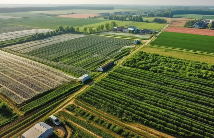
Yongbei Irrigation District, the largest planned irrigation complex under current provincial water network schemes, spans nineteen townships across five county-level jurisdictions belonging to Nanning and Hechi cities, with a designed irrigation coverage of 1.49 million mu and planned domestic water provision for roughly one million local residents. Decades-long over-reliance on scattered underground well water has triggered excessive groundwater extraction across the service territory, with ageing legacy irrigation infrastructure further limiting stable surface water supply. Parts of the zone serve as core agricultural production hubs, containing key grain-growing counties designated for China’s national grain output upgrading initiative and the province’s exclusive hybrid corn seed breeding base, plus major sugarcane planting zones prioritised for high-standard farmland development. Strict regulatory caps on underground water abstraction make previous well-reliant farming unworkable, fuelling widespread local anticipation for cross-mountain surface water diversion from major river systems.
The ongoing construction draws raw water from Hongshui River and Xianhu Reservoir before channelling flows towards Yujiang River via a 46-kilometre-long primary tunnelling network. Key auxiliary adits at Malingshan Town confront steep terrain and dense subsurface groundwater, requiring detailed underground karst and hidden river exploration ahead of formal excavation works. Project teams develop tailored technical contingency plans targeting geological risks inherent to long-distance karst tunnelling. Upon full breakthrough of the core tunnel system, nearly 200 kilometres of new backbone water pipelines, twenty-eight pumping stations and more than one hundred elevated storage ponds will be built to enable gravity-fed farm irrigation for surrounding croplands. Ongoing tunnelling advances steadily as local residents await formal water delivery upon project completion.
Along the Beibu Gulf coastline, vulnerable outdated seawalls expose coastal settlements to periodic seawater inundation. Guangxi’s continental coastal stretch totals 1,629 kilometres, with only 28 per cent of existing sea dykes meeting national construction criteria, below the national average benchmark of 40 to 50 per cent for China’s coastal provinces and municipalities. Most substandard embankments date back to spontaneous rural construction decades ago, built from compacted earth with flood resistance below once-in-five-year tidal safety thresholds. Daguan Sha seawall in Beihai City, first erected in 1965, safeguards tens of thousands of mu of coastal farmland; roughly four kilometres of its length received standardised reinforcement complying with once-in-twenty-year storm surge defence standards back in 2003, with a 1,300-mu mangrove wetland developed alongside the dyke to support integrated coastal ecological tourism zones combining flood prevention, wetland conservation and leisure functions.
Existing coastal seawalls across the Beibu Gulf shield 2.4 million residents and 1.11 million mu of cultivated land, yet upgraded standard-compliant segments remain scarce. National renovation plans launched in 2025 raise unified anti-tidal specifications for regional coastal infrastructure, mandating urban sea dykes withstand once-in-fifty-year extreme tidal events and rural farmland barriers resist once-in-twenty-year surge impacts. Administrative departments will roll out staged dyke renovation in line with population distribution and arable land layout across coastal counties and towns in subsequent construction cycles.
North Beibu Gulf Guangxi Water Resources Allocation Project, the province’s largest single-scale water conservancy initiative to date, extracts regulated freshwater from Yujiang River before transporting resources via a 491-kilometre full-span conveyance pipeline network to four key cities: Nanning, Beihai, Qinzhou and Yulin. Construction proceeds at Niuweiling Pumping Station positioned upstream of Niuweiling Reservoir in Yinhai District, a pivotal front-end facility supplying raw water to Beihai’s third urban water treatment plant. Finished project operations will substitute large volumes of previously exploited underground water to ease coastal freshwater scarcity, and return irrigation water previously diverted for residential daily consumption back to cropland use.
Once fully commissioned, the cross-basin allocation project delivers reliable tap water to around 14 million permanent local residents, restores and improves irrigation coverage spanning 1.3 million mu of farmland, cuts excessive underground water extraction volumes and replenishes environmental runoff for major local rivers including Nanliu River and Qinjiang River to rehabilitate inland aquatic ecosystems. Multiple segments of Guangxi’s core provincial water grid keep advancing under unified provincial hydraulic planning, continuing to iron out long-term geographical and seasonal water mismatches across the entire autonomous region.